RasterToWorldCoordX Class Reference
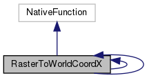
Inheritance diagram for RasterToWorldCoordX:

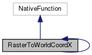
Collaboration diagram for RasterToWorldCoordX:

Public Member Functions | |
| String | getURI () |
| boolean | isSupported (KiWiDialect dialect) |
| Return true if this function has available native support for the given dialect. More... | |
| String | getNative (KiWiDialect dialect, String... args) |
| Return a string representing how this GeoSPARQL function is translated into SQL ( Postgis Function ) in the given dialect. More... | |
| ValueType | getReturnType () |
| Get the return type of the function. More... | |
| ValueType | getArgumentType (int arg) |
| Get the argument type of the function for the arg'th argument (starting to count at 0). More... | |
| int | getMinArgs () |
| Return the minimum number of arguments this function requires. More... | |
| int | getMaxArgs () |
| Return the maximum number of arguments this function can take. More... | |
| Double | attribute (GridCoverage raster, Integer longitude, Integer latitude) |
| Value | evaluate (ValueFactory valueFactory, Value... args) throws ValueExprEvaluationException |
Static Package Functions | |
| [static initializer] | |
Member Function Documentation
◆ [static initializer]()
|
staticpackage |
◆ attribute()
|
inherited |
References Coordinate.x.
◆ evaluate()
|
inherited |
References RasterAttributeIntIntDoubleFunction.attribute(), and LiteralRegistry.getLiteral().
◆ getArgumentType()
| ValueType getArgumentType | ( | int | arg | ) |
Get the argument type of the function for the arg'th argument (starting to count at 0).
This is needed for SQL type casting inside KiWi.
- Parameters
-
arg
- Returns
References ValueType.GEOMETRY.
◆ getMaxArgs()
| int getMaxArgs | ( | ) |
◆ getMinArgs()
| int getMinArgs | ( | ) |
◆ getNative()
| String getNative | ( | KiWiDialect | dialect, |
| String... | args | ||
| ) |
Return a string representing how this GeoSPARQL function is translated into SQL ( Postgis Function ) in the given dialect.
- Parameters
-
dialect args
- Returns
References FN_POSTGIS.st_rasterToWorldCoordX.
56 * The following condition is required to read WKT inserted directly into args[0] and create a geometries with SRID
59 * st_AsText condition: It is to use the geometry that is the result of another function geosparql.
62 if (args[0].contains("POINT") || args[0].contains("MULTIPOINT") || args[0].contains("LINESTRING") || args[0].contains("MULTILINESTRING") || args[0].contains("POLYGON") || args[0].contains("MULTIPOLYGON") || args[0].contains("ST_AsText")) {
◆ getReturnType()
| ValueType getReturnType | ( | ) |
Get the return type of the function.
This is needed for SQL type casting inside KiWi.
- Returns
References ValueType.DOUBLE.
◆ getURI()
| String getURI | ( | ) |
References FN_POSTGIS.st_rasterToWorldCoordX.
