GeomCRSToWKTTest Class Reference
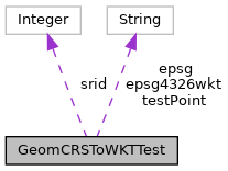
Collaboration diagram for GeomCRSToWKTTest:

Public Member Functions | |
| void | testGeomCRSToWKT () |
Static Public Attributes | |
| static final String | testPoint ="<http://www.opengis.net/def/crs/EPSG/0/4326> POINT(1 2 3)" |
Package Attributes | |
| String | epsg ="EPSG:4326" |
| Integer | srid =4326 |
| String | epsg4326wkt ="GEODCRS[\"WGS 84\",DATUM[\"World Geodetic System 1984\",ELLIPSOID[\"WGS 84\", 6378137.0, 298.257223563, LENGTHUNIT[\"metre\", 1]]],PRIMEM[\"Greenwich\", 0.0, ANGLEUNIT[\"degree\", 0.017453292519943295]],CS[ellipsoidal, 2],AXIS[\"Latitude (B)\", north, ORDER[1]],AXIS[\"Longitude (L)\", east, ORDER[2]],ANGLEUNIT[\"degree\", 0.017453292519943295],SCOPE[\"Horizontal component of 3D system. Used by the GPS satellite navigation system and for NATO military geodetic surveying.\"],AREA[\"World.\"],BBOX[-90.00, -180.00, 90.00, 180.00],ID[\"EPSG\", 4326, \"9.7\", URI[\"urn:ogc:def:crs:EPSG:9.7:4326\"]]]" |
Member Function Documentation
◆ testGeomCRSToWKT()
| void testGeomCRSToWKT | ( | ) |
String epsg4326wkt
Definition: GeomCRSToWKTTest.java:21
static final String testPoint
Definition: GeomCRSToWKTTest.java:19
References GeomCRSToWKTTest.epsg4326wkt, GeometricStringExportFunction.evaluate(), WKTDatatype.LiteralIRI, and GeomCRSToWKTTest.testPoint.
Member Data Documentation
◆ epsg
|
package |
◆ epsg4326wkt
|
package |
Referenced by GeomCRSToWKTTest.testGeomCRSToWKT().
◆ srid
|
package |
◆ testPoint
|
static |
Referenced by GeomCRSToWKTTest.testGeomCRSToWKT().
