Wrap the 'Encoded Polyline Algorithm Format' defined in: Google Maps API with flags to encode various Shapes: Point, Line, Polygon, etc. More...
Classes | |
| class | Encoder |
| Encodes a sequence of LatLngs into an encoded path string. More... | |
Public Member Functions | |
| String | getFormatName () |
| void | write (Writer output, Geometry shape) throws IOException |
| void | write (Encoder enc, Geometry shape) throws IOException |
| String | toString (Geometry shape) |
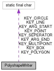
Static Public Attributes | |
| static final char | KEY_POINT = '0' |
| static final char | KEY_LINE = '1' |
| static final char | KEY_POLYGON = '2' |
| static final char | KEY_MULTIPOINT = '3' |
| static final char | KEY_CIRCLE = '4' |
| static final char | KEY_BOX = '5' |
| static final char | KEY_ARG_START = '(' |
| static final char | KEY_ARG_END = ')' |
| static final char | KEY_SEPERATOR = ' ' |
Detailed Description
Wrap the 'Encoded Polyline Algorithm Format' defined in: Google Maps API with flags to encode various Shapes: Point, Line, Polygon, etc.
For more details, see FORMATS.md
This format works well for geographic shapes (-180...+180 / -90...+90), but is not appropriate for other coordinate systems
- See also
- Google Maps API
- PolyshapeReader
Member Function Documentation
◆ getFormatName()
◆ toString()
| String toString | ( | Geometry | shape | ) |
References PolyshapeWriter.write().
Referenced by PolyshapeDatatype.unparse().
◆ write() [1/2]
| void write | ( | Writer | output, |
| Geometry | shape | ||
| ) | throws IOException |
Referenced by PolyshapeWriter.toString().
◆ write() [2/2]
| void write | ( | Encoder | enc, |
| Geometry | shape | ||
| ) | throws IOException |
Member Data Documentation
◆ KEY_ARG_END
|
static |
Referenced by PolyshapeReader.read().
◆ KEY_ARG_START
|
static |
Referenced by PolyshapeReader.read().
◆ KEY_BOX
|
static |
◆ KEY_CIRCLE
|
static |
Referenced by PolyshapeReader.read().
◆ KEY_LINE
|
static |
Referenced by PolyshapeReader.read(), and JtsPolyshapeWriter.write().
◆ KEY_MULTIPOINT
|
static |
Referenced by PolyshapeReader.read(), and JtsPolyshapeWriter.write().
◆ KEY_POINT
|
static |
Referenced by PolyshapeReader.read(), and JtsPolyshapeWriter.write().
◆ KEY_POLYGON
|
static |
Referenced by PolyshapeReader.read(), and JtsPolyshapeWriter.write().
◆ KEY_SEPERATOR
|
static |
Referenced by PolyshapeReader.read().